Дорогие пользователи программных продуктов ArcGIS в России и СНГ.
В соответствии с требованиями Esri, поставщика ArcGIS, мы приостанавливаем все продажи продуктов и услуг Esri в Россию и Беларусь. ООО Эсри СНГ продолжит поддерживать наших существующих клиентов. Вы можете связаться с нами по обычным каналам связи.
Dear CIS ArcGIS Users:
At the request of Esri, the provider of ArcGIS, we must suspend all sales of Esri products and services to Russia and Belarus. Esri CIS LLC will continue to support our existing customers. We can be reached via regular channels.
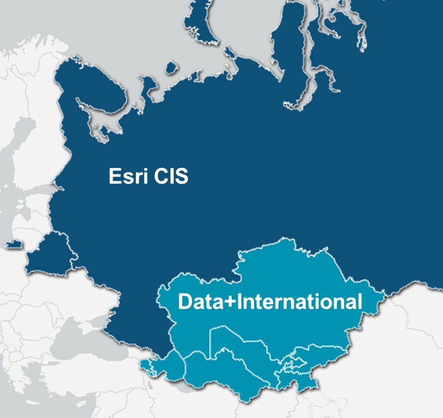
Data+ International
Официальный дистрибьютор Esri на территории Армении, Казахстана, Кыргызстана, Туркменистана и Узбекистана.
Пожалуйста, посетите сайт Data+ International, если вы обращаетесь из одной из этих стран.
Консультационная поддержка пользователей ArcGIS. Разработка и внедрение ГИС-приложений и сервисов, проектировании баз геоданных, а также интеграции ГИС с другими корпоративными информационными системами организации.
Свяжитесь с нами по почте market@esri-cis.ru или телефону +7 (495) 988 3481
Обучение ArcGIS
Изучите расписание учебного центра на 2026 год, пройти курсы можно очно и дистанционно.
Обучение ArcMap, ArcGIS Pro, ArcGIS Enterprise, базам геоданных, растрам, Python, FME и мобильным приложениям.